Village Hall
Bookings & Events
Hire Charges
Penllyn 5 Year Strategy
AGM Agendas
Agenda for the 2014 AGM
Agenda for the 2013 AGM
Agenda for the 2012 AGM
Agendas for the 2011 AGMs
Minutes of the Meetings
Minutes of AGM 2013
Minutes of AGM 2014
Notes from the Chair
Message from the Chairman Jun 2014
Message from the Chairman Jun 2013
Message from the Chairman Mar 2013
Message from the Chairman 2012
Message from the Chairman Nov 2011
The Church of St John
Summer 2013
Spring 2013
Village Maps
Penllyn & Craig Penllyn
Area Map
Parish Map
Local Government Information
Vale of Glamorgan Local Development Plan
Information on your property and surroundings
Transport
Rail and Bus Map
Local Links & Services
Local Businesses
The Complete Story
Your Special Site ...
SSSI Citation
Controlled Operations
Map
Field Species
Hay Rake 2011
The Winchfield
Winchfield Project Path
The Wells - Introduction
Penllyn Village Wells Project
Background
The Design of the CADW Plaque
An Artist's Impression of the Site
Photograph from 1938
The Excavation directed by Ray Caple
Site Plan after the Excavation
The Opening on 14th July 2000
Report in The GEM of the Opening
Photograph of the CPRW Award
Review of the Project
Finds from the Excavations
Summer 2016 Update
Those Who Helped
CADW
The Prince's Trust
The Heritage Lottery Fund
Penarth & District Scouts
Complementary Web Sites
Castles in Wales
Holy Wells
The Royal Commission
The Glamorgan-Gwent Archaeological Trust
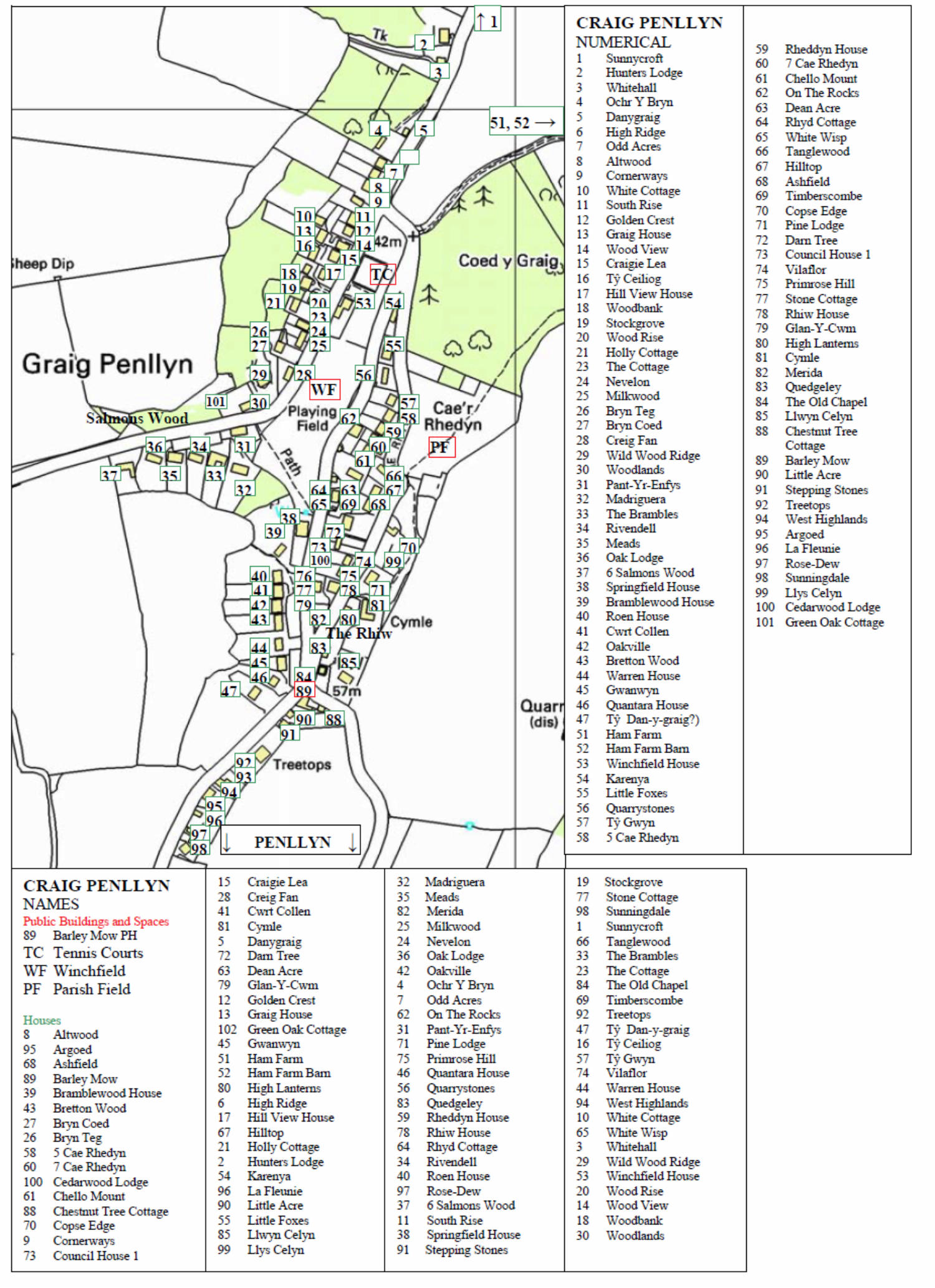
PENLLYN & CRAIG PENLLYN VILLAGE MAPS
Click on a map for a better view
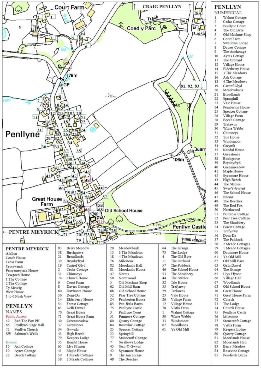
Maps are reproduced here with the kind permission of Val Caple who was responsible for compiling them.